27 min to read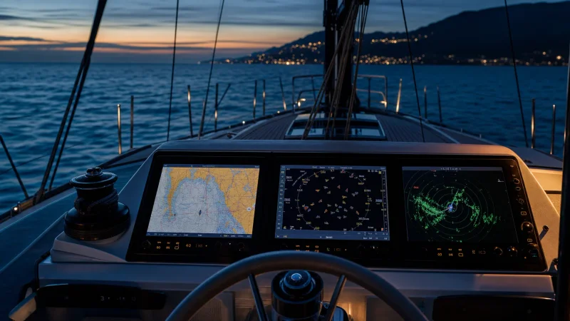
Imagine a pleasure yacht sailing on a pitch-black night through rough seas. Not a light in sight, fog rolling over the water, and in the distance, the faint lights of a passing vessel. In such conditions, a skipper naturally wonders: what can be relied upon besides one's own eyes? Fortunately, modern captains have three additional 'eyes' guiding the vessel—GPS, AIS, and radar. These electronic assistants become indispensable tools: one provides a bird's-eye view of your position on the chart, another 'communicates' with surrounding vessels, and the third sees through darkness and fog. Let's examine how these three systems work, their benefits and limitations, and why safe navigation requires using all three together.
GPS: An Eye from Space
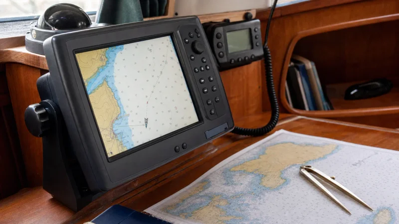
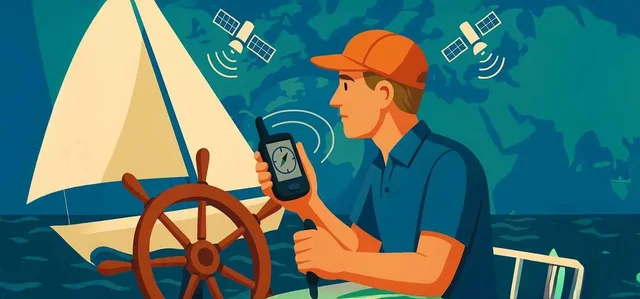
GPS (Global Positioning System) is a satellite navigation system that provides your vessel with coordinates accurate to within a few metres. Simply put, GPS is your electronic navigator, constantly aware of your location. A GPS receiver picks up signals from multiple satellites and calculates its position based on signal transit times. The result is your vessel's real-time latitude and longitude, altitude (less relevant for ships), and highly accurate Course Over Ground (COG) and Speed Over Ground (SOG).
How GPS Works on a Yacht
How it works: A GPS device on a yacht continuously listens to radio signals from orbiting satellites. By calculating the signal transit times from multiple satellites, it determines your position through trilateration. Modern receivers utilize not only American GPS satellites, but also equivalent systems—GLONASS, Galileo, BeiDou—to increase reliability and precision. Thus, GNSS is technically the more accurate term, though GPS remains in common usage. The derived GPS coordinates are instantly transmitted to a chartplotter—an electronic chart—where you can view your position and plan a route. GPS data is also integrated into other instruments: for example, AIS uses the GPS position to broadcast to other vessels, while radar uses it to overlay targets onto the chart. Additionally, GPS provides a master time reference to all onboard electronics—acting as a clock 'pulse' to keep everything synchronized.
Practical Application of GPS on a Yacht
Practical application: For a skipper, GPS represents a true revolution compared to paper charts and sextants. On the chartplotter display, your yacht appears as a symbol on an electronic chart, immediately showing surrounding shorelines, navaids, and depths. You can lay down a route, and an autopilot interfaced with the GPS will steer the vessel precisely along the track. GPS indicates your speed over ground and helps estimate your estimated time of arrival (ETA). In short, this space-based 'eye' replaces an entire team of traditional navigators!
The Main Limitation of GPS on a Yacht
However, GPS is not omnipotent. Its primary limitation is that it cannot detect obstacles. GPS shows your position on a chart, but it will not warn you of an unmarked drifting buoy or a small boat dead ahead. Nor does GPS display local weather or surrounding vessels—it simply provides coordinates. This is where other systems, such as radar and AIS, come to the rescue. Furthermore, GPS signals can fail: in narrow fjords or enclosed coves, signal reception may be lost, while interference or intentional jamming can temporarily 'blind' a GPS receiver. There have been instances where GPS failures led vessels off course—one bulk carrier off Australia nearly ran aground on a reef due to a faulty GPS antenna sending incorrect position data to all onboard instruments. The crew relied too heavily on the electronic chart and failed to notice via radar and navigation lights that the reef was much closer. Only at the last moment did the pilot spot the red sector of a coastal lighthouse and alter course away from danger. The takeaway is simple: always cross-check GPS using alternative methods, especially near navigational hazards. Fortunately, a vessel has other 'eyes' available.
Advantages of GPS:
• Provides accurate position coordinates, course, and speed anywhere on Earth.
• Enables route planning and automated track keeping when interfaced with an autopilot.
• Synchronizes onboard electronics by providing precise time and position data to AIS, chartplotters, emergency beacons, etc.
• User-friendly: displays position directly on an electronic chart that is easy to understand even for beginners.
Disadvantages of GPS:
• Cannot detect obstacles or other vessels—it only indicates position on a chart.
• Dependent on satellite signals: vulnerable to interference, masking (in canyons or tight ports), intentional jamming, or spoofing.
• Positional accuracy is typically 3–5 m, which is adequate for general navigation, but small navigational hazards (reefs, shoals) still require safety margins. Chart offset errors or incorrect settings (such as a wrong map datum) can result in inaccurate position plotting.
• In the event of a total electrical failure, GPS is useless—paper charts and traditional navigation skills are required as a backup.
Your satellite navigator, GPS, forms the backbone of modern navigation. However, knowing your position alone is not enough to see what surrounds your vessel. Next, we engage the second 'eye'—the AIS system, which makes you visible to others while displaying surrounding targets on your screen.
AIS: Electronic Vision with the Big Picture
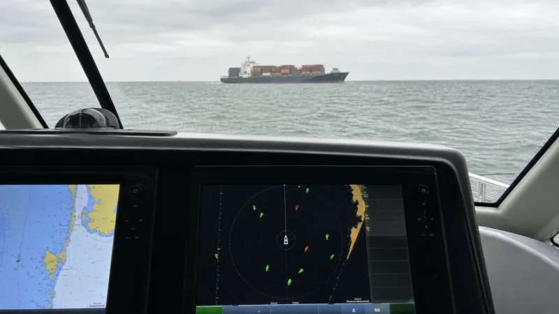
AIS (Automatic Identification System)is, figuratively speaking, an electronic business card exchange between vessels. Every vessel equipped with an AIS transponder automatically broadcasts its details into the airwaves: who you are, where you are, where you are heading, and at what speed. An AIS unit consists of a small VHF radio transmitter combined with a GPS receiver. At regular intervals (ranging from every 2 seconds to several minutes, depending on class and speed), it broadcasts your call sign, coordinates, course, speed, and other data, while simultaneously receiving similar transmissions from other vessels. Simply put, AIS allows vessels to 'see' each other on electronic charts long before making visual contact.
What is transmitted and who sees it: A standard AIS broadcast includes your unique MMSI number, vessel name, vessel type (yacht, tanker, fishing vessel, etc.), dimensions, navigational status (e.g., under power, at anchor), current position coordinates, course, and speed, and sometimes additional information such as destination, ETA, and draught. All this data is received by any vessel within range equipped with an AIS receiver, as well as shore stations and orbiting satellites. Picture this: your 40-foot yacht broadcasts its signal, and the captain of a massive container ship several miles away immediately sees a small yacht nearby on screen, complete with its name and course. This drastically reduces the risk of remaining undetected. Conversely, you can see approaching vessels and their parameters, enabling you to assess collision risks well in advance.
How AIS aids in collision avoidance: On a chartplotter or dedicated AIS display, target vessels are usually displayed as triangles or dots with course vectors. The system automatically calculates the CPA (Closest Point of Approach) and TCPA (Time to Closest Point of Approach). If a risk of collision exists, the system triggers an audible alarm. Crucially, AIS does not merely show an anonymous dot; it provides the vessel's name, radio call sign, type, and dimensions. Armed with the vessel's name, you can contact it directly over VHF radio: 'Tanker Poseidon, this is sailing yacht Breeze, on your starboard bow...'—an invaluable feature for negotiating passing arrangements. Thus, AIS is not a passive radar echo, but a cooperative beacon announcing to everyone nearby: 'Here I am, and these are my intentions.' In restricted visibility (fog, night), AIS offers essential reassurance: it electronically reveals targets that would otherwise be invisible to the naked eye. This is especially useful near harbour approaches and shipping lanes with heavy traffic, where AIS helps eliminate blind spots inherent to radar and human sight.
For instance, AIS can detect targets hidden behind bends or islands that lie beyond a radar's direct line of sight. AIS signals operate in the VHF band (162 MHz), which features longer wavelengths than microwave radar transmissions. Consequently, AIS radio waves can diffract around minor obstacles, achieving impressive ranges—often 20–30 nautical miles with a high-mounted antenna. In practice, a Class B AIS installed on a yacht typically reaches 5–10 nautical miles, whereas high-powered Class A commercial transponders transmit signals over 20+ nautical miles. Range depends largely on antenna height and atmospheric conditions. Nonetheless, AIS reception range frequently exceeds visual range and even small-craft radar range. In effect, AIS can illuminate targets beyond the horizon or through clutter where radar fails to detect them.
Naturally, AIS is no panacea. Its primary limitation is that you can only see vessels actively transmitting. A small craft without a transponder remains invisible on screen. Rocks, drifting shipping containers, and floating logs will never appear on AIS. Furthermore, even certain large vessels might not transmit: fishing vessels occasionally disable AIS to conceal productive grounds, while naval ships may switch off AIS for security reasons. Relying solely on AIS leaves you vulnerable to 'silent' targets. In such scenarios, radar is indispensable—more on that below. Another detail: AIS data updates periodically rather than continuously. Class A commercial targets transmit every 2–10 seconds under way, whereas Class B yacht units update approximately every 30 seconds (or up to every 3 minutes when stationary). As a result, a target displayed on screen may lag slightly behind real time. At low speeds this is negligible, but if you track a high-speed motorboat via AIS, remember that its actual physical position may be ahead of the displayed icon. Radar provides real-time response by comparison—returns move in sync with the physical target. Modern integrated navigation systems frequently overlay AIS tracks onto radar targets, highlighting discrepancies and showing how radar returns often lead AIS icons due to transmission delays.
Advantages of AIS for Sailors:
• 'Sees and shares': provides real-time information on all AIS-equipped vessels around you while broadcasting your position to them, dramatically reducing collision risk and providing vital reaction time.
• Vessel details: displays vessel name, type, dimensions, course, speed, and destination, allowing for a comprehensive situational assessment (e.g., distinguishing a commercial tanker constrained by a fairway from a recreational craft crossing your heading).
• Calculates collision parameters (CPA, TCPA) automatically and triggers audible alarms for dangerous approaches.
• Facilitates VHF communications: knowing a vessel's name or call sign allows you to initiate direct radio contact and agree on maneuvering intentions, unlike an anonymous radar return.
• Extended range: often exceeds visual sightlines and small-craft radar coverage, providing the ability to detect targets beyond the horizon or around landmasses.
• Search and Rescue: AIS technology is integrated into emergency transmitters and personal MOB (Man Overboard) beacons. If a crew member falls overboard wearing an AIS beacon, a distress target with precise coordinates appears instantly on nearby screens, accelerating recovery.
• Reduced bridge stress: knowing surrounding traffic while knowing others see you boosts a skipper's confidence. For example, at night, it is reassuring to know that the officer of the watch on a passing supertanker can clearly identify your 45-foot yacht nearby.
Disadvantages of AIS:
• Limited equipment coverage: it only shows vessels and targets equipped with an active AIS transponder. Small craft without AIS, buoys, shoals, whales — all these remain invisible.
• Update delay: especially for Class B AIS targets — data may only update every few dozen seconds, so high-speed targets may no longer be where the icon shows.
• Range limited to line-of-sight: beyond 20–30 miles, or if a mountain obstructs the signal, you will not see the target (although shore repeaters and satellites partially address this by forwarding data via the internet, internet access is not always available offshore).
• Channel congestion: in extremely busy areas (major ports, concentrations of hundreds of vessels), the AIS channel could theoretically become congested. However, this is rare in yachting practice.
• Power consumption and installation: an AIS unit itself consumes little power, but it requires a masthead VHF antenna and a connection to a chartplotter. However, many modern VHF radios already feature a built-in AIS receiver.
• Privacy concerns: some sailors dislike having their movements visible to everyone (via websites like MarineTraffic). While less critical for recreational boating, some choose to turn off AIS outside busy areas. Safety comes first, however — it is always better to remain visible.
A practical example: imagine you are leaving a Mediterranean marina in morning fog. Visibility is 200 metres, but on your AIS screen you can already see a ferry underway two miles off, and slightly to the side, a tanker at anchor. You plan your manoeuvre well before hearing the roar of the ferry's turbine. Then comes a surprise: dead ahead, an echo appears on the radar that is not on AIS! It looks like a small fishing boat without a transponder. You are glad you took the time to switch on the radar when leaving in the fog. Let us move on to this third electronic 'eye'.
Radar: Seeing Through Fog and Night
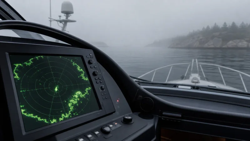
Radar is the oldest of the three electronic aids, but no less important for it. The word RADAR stands for Radio Detection And Ranging. It works on a principle similar to a depth sounder, using radio waves instead of sound. Radar transmits short microwave pulses and detects the reflected signal. By measuring the echo return time, radar calculates the distance to the target, and by the antenna direction — its bearing (direction relative to the bow). You see the result on the screen as blips — dots or patches positioned just like real objects around you. Simply put, radar displays a real-time picture of the surrounding environment, regardless of light and visibility.
What Radar 'Sees' on a Yacht
What radar 'sees': almost anything that reflects radio waves. Other vessels (even without lights, even hidden by fog or night), coastlines, islands, large buoys and navigational marks, rocks, and rain squalls (heavy rain clouds produce distinct blips). Radar is your reliable night watchman or a 'magic lantern' illuminating obstacles in the dark. In thick fog, radar literally becomes your eyes: as soon as a small craft enters a 2–3 mile range, a target appears on screen. Many experienced skippers say: if you sail at night or in fog, radar is indispensable and no AIS can replace it. After all, radar picks up targets that transmit no signal — from a kayaker to a floating log, from a rock to a semi-submerged container. Under ideal conditions, a powerful yacht radar (with a good antenna) will spot a large ship at 20–24 miles, the coast at about 16 miles, and a yacht at a few miles (exact figures depend on antenna height and target size). Most importantly, at close range (up to a few miles), radar provides the most accurate and up-to-date information. It continuously scans the surroundings, updating the display every second, whereas AIS can remain 'silent' for a couple of minutes. For example, a vessel's manoeuvre — an echo shift — is immediately visible on radar, while AIS will show the change in course or speed with a delay.
Radar and Night Navigation on a Yacht
Radar in blind navigation: Radar was historically used for instrument navigation. Long before the GPS era, navigators plotted their course using radar by tracking coastlines, headlands, and buoys. Today, with digital charts on display, radar imagery is often overlaid directly onto the chart. Modern chartplotters offer radar overlay: target echoes are rendered right over the nautical chart. This is extremely convenient — you can instantly tell which blip corresponds to a headland or buoy on the chart and which echoes have no chart match (meaning another vessel or unmapped object). AIS icons are usually displayed simultaneously as well. The complete picture is right before your eyes: coastline, navigational marks, rain squalls, vessels with and without AIS — all distinguishable by target type. This combined screen truly brings environmental awareness to life.
An example of a radar overlay on an electronic chart (red blips) along with AIS targets. This helps the skipper distinguish stationary objects (shoreline, buoys — whose echoes align with chart contours) from moving vessels, even in dense fog.
In addition, radar allows you to track targets. The MARPA or ARPA feature lets you 'acquire' a selected blip and automatically calculate its course, speed, CPA, and TCPA — similar to what AIS does. The difference is that radar calculates target motion relative to you independently, without requiring any transmitted signals from the target. This is useful when an oncoming vessel lacks AIS — you can still assess collision risks. Modern features like Doppler mode highlight moving targets in color (for example, targets approaching you are highlighted red or yellow). This immediately draws attention: 'that motorboat is overtaking us from behind, stay alert'.
Radar Limitations on a Yacht
Radar limitations: Radar requires a skilled operator. First, it must be properly tuned. Gain set too high causes clutter from sea spray and rain (false echoes); gain set too low, and a small yacht might go unnoticed. Manufacturers continually improve clutter filtering algorithms, but the human factor remains: you must know how to adjust gain, rain clutter, and sea clutter controls. Beginners sometimes find radar displays hard to interpret, as they differ from standard charts. There have even been 'radar-assisted collisions' when navigators misread what they were seeing. Second, radar has blind spots and physical limitations. Naturally, it cannot see behind a high mountain — radio waves travel virtually in straight lines. A small fiberglass target may return a weak echo and get lost in clutter. This is why yachts often fit reflectors (radar reflectors or active radar target enhancers) to increase their visibility on commercial radar screens. A small yacht's radar echo is typically detected no further than 2–3 miles away, or even closer in rough seas — and then only if watching closely. In one real incident, a 13-metre yacht crossed the course of a container ship at night and was nearly run down: the yacht carried neither AIS nor radar, and the ship's bridge crew missed its faint clutter on screen. The investigation revealed the yacht's echo had appeared on radar 20 minutes prior to collision, but no one noticed it — a tiny blip while the watch crew was distracted with other tasks. Conclusion: small targets are hard to spot on radar unless you watch intently. AIS would have clearly drawn attention on screen in that situation, but it was absent. Combining both methods is best: if a yacht carries an AIS transponder, large vessels will see both the icon on screen and the radar echo — greatly increasing the chances of being noticed.
Finally, radar is an active device emitting a high-power signal, which requires substantial electricity. Under engine power this is rarely an issue, but under sail when conserving battery power, some sailors hesitate to run radar. Modern technology has eased this challenge: solid-state (digital) radars consume significantly less power than older magnetron units and require no warm-up time. Such radars can run continuously without draining batteries — consuming little more than a light bulb while offering instant readiness. Antenna weight on the mast is also reduced — down to 5 kg for compact models. As a result, radar is now a standard feature even on 30–40 ft cruising yachts.
Advantages of Radar:
• Operates in all visibility conditions: fog, darkness, and rain are no barrier. Radar provides a situational overview independent of human vision.
• Detects all physical objects: regardless of whether the target carries electronics. Any physical obstacle of sufficient size (vessel, shoreline, buoy, rock, floating container) reflects the signal and appears on screen. Thus, radar complements AIS by covering its blind spots.
• Instantaneous display updates: continuous scanning. Object positions are displayed with minimal delay (standard radar rotates at 24 rpm, updating roughly every 2.5 seconds, while modern Doppler radars reach up to 60 rpm, updating every second).
• Direct measurement of distance and bearing: highly accurate relative position data. If radar shows a target at 2.00 miles, that is its exact distance, regardless of chart or datum errors. For this reason, radar serves as an excellent check on GPS chart accuracy: you can compare shoreline radar returns with chart contours. Discrepancies indicate possible chart or GPS positioning errors.
• Aids coastal navigation: radar allows you to track coastlines, navigate narrow channels, and enter harbours. For instance, when coasting in the dark, you can see headlands ahead, straits, and islets on screen, verifying that turns are made at the correct position.
• Detects precipitation and squalls: in weather mode, radar detects approaching rain fronts and thunderstorm cells. Experienced sailors use radar to gauge the size and direction of storm clouds in order to adjust course or prepare for gusts.
• Independence: your radar is your own sensor. It does not rely on external systems (satellites or third-party transmitters) and operates autonomously as long as power is supplied.
Disadvantages of Radar:
• Requires skill and attention: you must understand its operating principles, know how to tune clutter filters, and interpret echoes correctly. To an untrained operator, the radar screen can look like a mess of clutter. Practice is essential, especially when manually adjusting sensitivity.
• Shadow zones and missed targets: small targets (wooden boats, SUP paddlers) may fail to show due to low reflectivity or wave clutter. Objects masked by an island or large vessel remain hidden (no radio line-of-sight).
• Limited detection range for small targets: while a yacht's AIS signal can theoretically reach tens of miles, spotting a yacht on radar beyond 5–6 miles is rare. Typically, detection range for a fiberglass yacht is 2–3 miles under favorable conditions. Thus, AIS-equipped yachts will detect each other far earlier than radar will — another strong argument for carrying AIS.
• False targets: waves, rain, and interference from other radars can generate false echoes. Occasionally, radar picks up distant features or storms that pose no threat but can cause confusion for inexperienced operators.
• Cost and power consumption: radar is more expensive than AIS. Although basic compact models have become more affordable, it remains a significant investment. Power consumption is another factor — older radars draw considerable power (~20–40 W when transmitting). Modern units draw less, but still noticeably more than AIS (<5 W). Having both is ideal, but sailors on a limited budget often choose AIS for its affordability and simplicity. Nevertheless, experience shows that anyone caught in dense fog soon considers buying radar if they do not already have one.
Why Using All Three Systems Together Is Essential
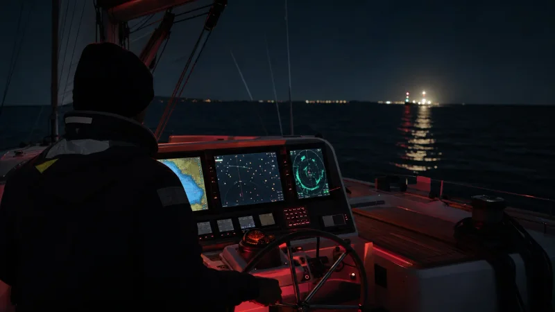
As we can see, each of these 'three eyes' provides its own view of the surrounding world. GPS tells you where you are on the chart and where you are headed, but cannot reveal who or what is around you. Radar shows physical objects around you, but cannot identify them or state their intentions, and it may miss small targets. AIS provides data on other vessels and their courses, but cannot display non-transmitting targets — neither shorelines nor boats without transponders. Only by integrating all three systems do you gain a complete situational awareness and establish redundant layers of safety.
Mariners call this the principle of redundancy: you should never rely on a single source of navigational information. Seamanship is full of examples where the absence of just one element led to danger. We have already mentioned a couple of cases: a yacht without radar and AIS narrowly escaped disaster under the bow of a container ship, while the crew of a large vessel, relying solely on GPS, nearly ran their ship aground. There are also less dramatic but equally telling situations:
• Foggy morning in a strait: You only have AIS onboard and no radar. You see several ships on the screen and alter course to clear them... when suddenly, dead ahead, the silhouette of a small fishing boat appears! No navigation lights, no AIS—lucky you managed to take evasive action in time. Breathing a sigh of relief, you think: “I should have installed radar; it would have picked him up well in advance.”
• Offshore night race: You are the skipper of a 50-foot racing yacht, flying under spinnaker. Ahead is a thunderstorm front, a solid wall of rain, and zero visibility. Radar set to weather mode shows heavy rain cells, so you skirt around the edge. Suddenly, AIS targets come to life ahead—two oncoming cargo ships. Their AIS signals are received 15 nautical miles out, even though they are buried in rain clutter on the radar. Now forewarned, you plot a safe passage between them. The takeaway: in a torrential downpour, radar suffers from rain clutter, while AIS continues to work reliably. But if those targets were an island or a reef instead of vessels, AIS would tell you nothing, whereas radar would detect them. Once again, you need both.
• Electronics failure: Imagine a blown fuse cuts power to your chartplotter and GPS. It's night, and your position is unknown. But the radar is still working! Using it for orientation, you see the coastline and light buoys (which the radar also displays as targets) and can estimate your position using the classic method of radar bearings. Or at least you drop anchor, seeing on radar that you are at a safe distance from shore. Without radar, this would turn into a lottery.
• False sense of security: You are sailing in open water during the day with excellent visibility. You decide radar isn't needed since you can see everything visually, and the AIS is silent—looks like there's no traffic around. You relax... and a short while later, a submarine (or a high-speed RIB) suddenly appears out of nowhere. It turns out it was beyond AIS radio range or operating without it. Radar might have picked it up much earlier than the naked eye.
There are many examples, but the essence remains the same: an integrated approach to navigation is the key to safety. By using all available sensors, you compensate for each system's blind spots. In aviation, pilots live by the rule “Trust but verify”—trust an instrument, but verify it against another. It is the same at the helm of a yacht: if you spot a target on radar, check if there is an AIS target and what information it provides. If you see an approaching powerboat on AIS, locate its radar echo to confirm the data aligns. If GPS shows a rock 5 cable lengths away, check the radar: is the rock showing up at that range? If not, perhaps the GPS position is off or the chart is inaccurate. Cross-checking prevents many mistakes. It is no coincidence that seamanship manuals prescribe a layered defense: visual lookout + radar + AIS + GPS, rather than relying on any single tool.
Modern navigation suites: Integration for convenience
Fortunately, marine electronics manufacturers have ensured that a skipper does not need to become a three-eyed cyborg staring at separate instruments. Modern chartplotters integrate GPS, AIS, and radar data onto a single screen. Essentially, you have one or more large displays—Multi-Function Displays (MFDs)—where all information feeds into a single interface. GPS provides your position and syncs the chart, AIS overlay adds moving targets with vessel data, and radar overlays real-time echoes on top. It is like having both Google Maps and a thermal night-vision overlay at the same time—a chart base plus active real-world targets. You can toggle layers on and off: for example, showing radar only if you want an uncluttered image of return echoes, AIS only, or everything together. Either way, integration saves time and reduces crew workload: there is no need to constantly look back and forth between different screens and mentally combine them—the equipment does it for you.
Targets on screen are usually distinguished visually: AIS targets appear as triangles or vessel icons with course vectors, while radar echoes show as colored patches or dots. If they coincide geographically, it is the same object (a vessel broadcasting AIS). If you see a radar echo without an AIS target, it might be a craft without a transponder or another contact (a buoy, flock of birds, sea clutter—something requiring assessment). Conversely, if an AIS target appears without a radar echo, either the target is beyond radar range or it is very small (such as an AIS transponder on a buoy transmitting coordinates, while the buoy itself offers a weak radar cross-section). Understanding these details helps you correctly evaluate the situation.
In addition, autopilots and other onboard systems are linked. Many autopilots can receive AIS data—for instance, some can automatically alert you if your plotted route intersects with an AIS target's path at a low CPA (Closest Point of Approach), and even make subtle course adjustments. However, you should never rely entirely on automation—rule number one: navigational decisions are made by the watchkeeper. Instruments are advisors, not captains. Still, during long passages, integration is invaluable. Imagine having all close-quarters situations highlighted instantly on your screen (with AIS or radar marking dangerous targets in red or yellow), vessel names displayed, and coastline and channels clearly mapped. Technological progress has turned the helm station of even a small yacht into a mini air traffic control center!
Let's not forget mobile technology. Today, many sailors bring a tablet loaded with marine charts, connect it via Wi-Fi to the yacht's system, and access the same AIS and radar data right at their fingertips. You can relax below in the saloon with a cup of tea, checking the tablet to ensure all is quiet around you. The key is not to get carried away by comfort and forget to keep a regular visual lookout over the horizon 😊. Speaking of the human factor: three electronic eyes do not replace the good old Mk1 Eyeball—our own eyes. Maintaining a visual lookout is essential, and COLREGs explicitly require a continuous lookout at all times. Instruments assist, but unlit boats or unexpected hazards are often spotted only by a human eye. The winning combination is electronic aids plus a vigilant watchkeeper—ensuring nothing slips by unnoticed.
GPS vs AIS vs radar: quick comparison
GPS answers “Where am I?” and supplies position, course and speed. AIS answers “Who is transmitting nearby?” and adds vessel identity, heading and CPA/TCPA data. Marine radar answers “What physical object is actually there?” by detecting coastlines, buoys, rain squalls and vessels even when they do not carry AIS.
For collision avoidance, AIS cannot replace radar: a switched-off or absent transponder is invisible to AIS, while radar may still detect the target. Radar cannot replace AIS either, because it does not provide a vessel name, call sign or transmitted voyage data. The safest yacht setup combines GPS, AIS and radar and cross-checks all three against a visual lookout.
Conclusion: Your vessel is an Argus with a hundred eyes
In ancient Greek mythology, the giant Argus had a hundred eyes and was an unmatched guardian—always watchful. Your modern 50-foot cruiser may not be Argus, but it has three electronic eyes at its disposal, and it would be a mistake not to use them. Working together, GPS, AIS, and radar make sailing far safer and more comfortable, even on smaller yachts. Operating with just one instrument is like being a one-eyed Cyclops: you have sight, but with critical blind spots. By using all three, you will miss virtually nothing: GPS guides your course and position, AIS alerts you to fellow mariners over the horizon, and radar reveals whatever is hidden in darkness or fog.
This is especially relevant for owners and charterers of 30–70 foot yachts cruising European and Mediterranean waters. Traffic in these regions is dense—comprising both commercial shipping and pleasure craft—weather conditions vary, and waters are often unfamiliar. Invest in your safety: if your charter or private yacht lacks AIS or radar, consider having them fitted. Crucially, learn how to use them: practice in calm conditions, read the user manuals, and seek advice from experienced sailors. Rest assured, on a pitch-black night, these instruments will pay for themselves tenfold—and may well save your vessel from collision.
Finally, a lighthearted piece of advice: treat GPS, AIS, and radar like three wise watch officers. GPS is the navigating mate holding the chart, AIS is the radio officer broadcasting “Here we are! Where are you?”, and radar is the lookout with binoculars seeing what no one else can. Would you set sail without a navigator, a radio officer, and a lookout? 😉 Sailing without one of these devices is a compromise on your own safety. Keep your vessel vigilant through 360 degrees, day and night, so every passage remains an enjoyable and incident-free voyage!
Sources: GPS, AIS, and radar information aggregated from Sea Tow Boating Safety guides, B&G Sailing electronics tutorials, and real maritime incident case studies for accuracy and relevance.