In maritime pilotage, a cardinal mark is a buoy or fixed structure indicating the safest side to pass a navigational hazard. The name “cardinal” refers to the four cardinal compass points: North, East, South, and West. Each mark’s design, colours, topmark shape, and light characteristic uniquely identify the quadrant of safe water.
For instance, a North cardinal mark signals that safe water lies to its north; pass north of it. An East mark says safe water is east, so go east of it – and similarly for South and West. The topmarks consist of two black cones. North: both point up. East: base‑to‑base (hourglass). South: both point down. West: point‑to‑point (diamond). The colour pattern: North black above yellow; East black‑yellow‑yellow‑black; South yellow above black; West yellow‑black‑yellow.
Lights are white and flash in quick (Q, 50–60 flashes per minute) or very quick (VQ, 100–120 flashes per minute) rhythms. North: continuous Q or VQ. East: three flashes (Q(3) 5s or VQ(3) 5s). South: six flashes plus a long flash (Q(6)+LFl 15s or VQ(6)+LFl 10s). West: nine flashes (Q(9) 15s or VQ(9) 10s).
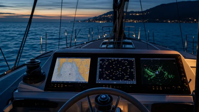
Always use a marine compass to take a bearing and confirm the mark’s quadrant. Modern GPS navigation can locate the mark on a chartplotter, but visual identification remains essential, especially when electronics fail or in poor visibility.
Quick answers
What is Cardinal mark?
A navigational mark indicating the safe side of a hazard relative to the cardinal compass points.
What is Cardinal mark used for on a yacht?
Remember that a cardinal mark does not define a channel but tells you where the deepest water lies. Always use a hand-bearing compass to check the bearing and pass on the indicated side. In fog, rely on the light character to identify the mark. On charts, they are marked with letters N, E, S, W and a distinctive symbol.
What topics are related to Cardinal mark?
Sources and verification
- Navi.training: GPS, AIS и радар. — «Три глаза» вашей яхты — знаете ли вы, в чём разница?
- Navi.training: Как работает GPS, и роль электронной навигации в мире яхтинга
- Navi.training: Компас на яхте: Как пользоваться морским компасом и для чего он нужен яхтсменам?
- Navi.training: GPS, AIS та радар. — «Три ока» вашої яхти — чи знаєте ви, в чому різниця?
- Navi.training: Як працює GPS та роль електронної навігації у світі яхтингу
- Navi.training: Компас на яхті: Як користуватися морським компасом і для чого він потрібен яхтсменам?
- Navi.training: GPS vs AIS vs Radar on a Yacht: What Each System Really Does
- Navi.training: How GPS Works and the Role of Electronic Navigation in the World of Sailing
- Navi.training: The Compass on a Sailboat: How to Use a Marine Compass and Why Sailors Need It
- Wikipedia: Stanford Cardinal · CC BY-SA 4.0 / GFDL
 27 min to read